
- Miles 604.7-618.8 (14.1 mi.)
- Total ascent: 2877’; descent: 2303’
Pay attention to the forecast in the mountains, and you’ll notice it’s not so reliable. Even supposedly current conditions online do not always match one’s on-ground experience.
This was one such morning. Our warmest temperatures were in the morning, though we never got a sliver of the partial sun predicted today. Instead, we got sleet and snow, with air temperatures as high as 45. The precipitation lasted almost until we reached Trent’s Grocery, the epitome of a small country store, to resupply and eat lunch.
The terrain out here encourages localized and unpredictable weather events. One of the more unnerving ones is known as an inversion: due to certain wind currents or pressures, I do not know, the air high on the mountain will occasionally be warmer than down in the valley. In a storm, an inversion gives one the sense they are going the wrong way leaving the ridge.
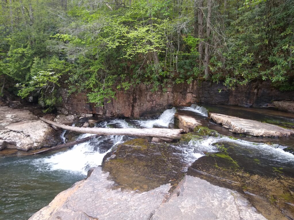
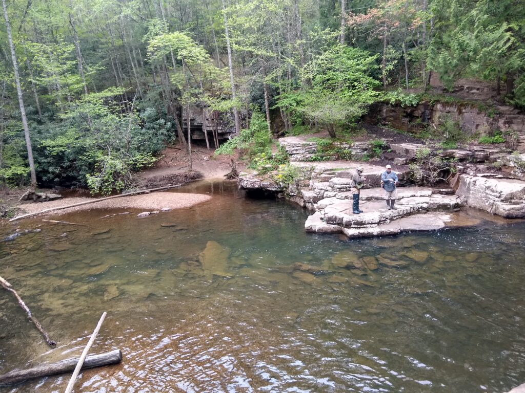
Right after Trent’s Grocery, we saw the unfairly named Dismal Falls. Dismal Falls was a multitiered fall, with a reddish rock and blue-green water. Many AT hikers aren’t keen on side trails, but it’s a widely taken one. The stream flowing over the falls is stocked with trout, and we watched two anglers catch five fat specimens in minutes.
One hiker who seemed to know what he was doing asked for, and was given, them. He and a friend, knives in hand, carried them to a nearby campsite. I hope they were delicious cooked over a fire.
In other tempting news, a close family friend who’s getting married re-announced a Covid-cancelled wedding reception in Asheville, NC, this July. I waited to respond for a few hours because I really wanted to go, but I had to admit that it would be difficult or impossible for us to arrange transportation to and from, and to meet our time budget for our hike. We will likely be in upstate New York or Vermont at that time of year, though still in the same Appalachian mountains as Asheville.
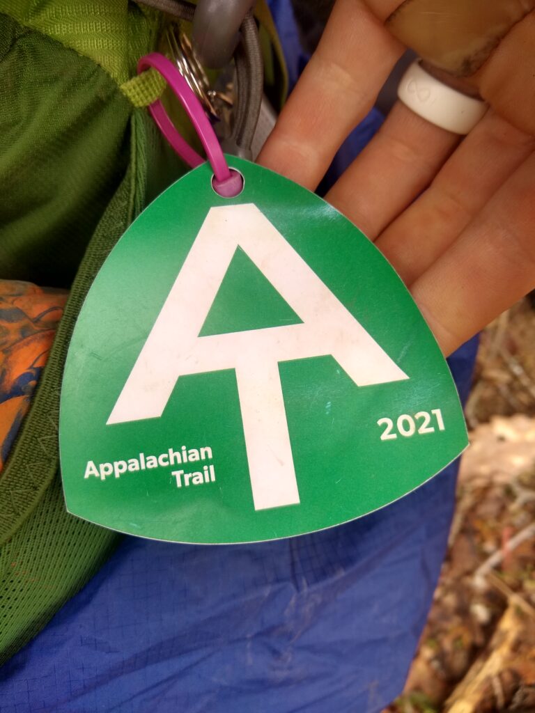
Finally, we got one more piece of news: The ATC is beginning to recognize thru-hikes again, and will be giving out hangtags for hikers packs at its visitors centers.
Although the timing of our hike will disqualify us for the 2,000 miler club, we aren’t upset. Our attitude, and the prevailing one on the trail, is that official recognition is not a necessary part of the hike. We also have beautifully counterfeit hangtags, made by Paperclip and an unknown graphic designer friend of his.
Tomorrow, we’ll traverse the WV-VA border for most of the day, though never actually crossing into West Virginia until the end of Virginia in 400-something miles. Our next destination, Pearisburg, is 11 miles from Roanoke. We’re nearing hiker’s favorite sights in VA: McAfee Knob and Dragon’s Tooth, coming up in the low 700s.
How incredible it is to be looking at that mileage number. Rachel and I have a lot more to do, but we keep hearing the old-timers say: You’re going to make it.